Measurements
Since its creation in 2012 MORDICS undertakes a long-term coastal monitoring program through the collection of meteorological, hydrodynamic and morphological measurements:
See the measurement locations

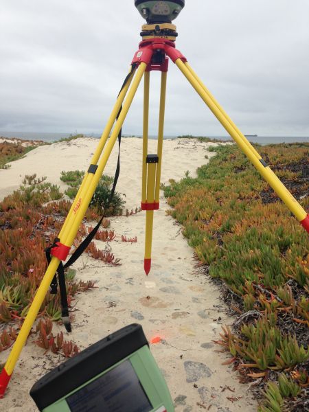
Topography
Beaches: Playa Hermosa (since Nov12); Granada Cove, Stacks y San Miguel (Ago15-Ago16); Ciprés and Barra del Estero (since Ago 15); La Misión (since Ago 15).
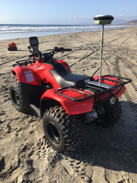
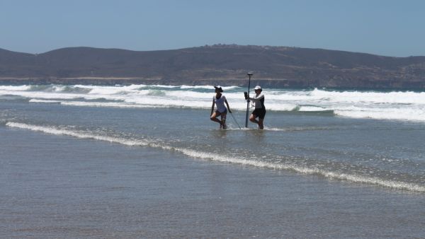
Instrumentation: differential GPS Leica (4 rovers GS14 and a reference station GNSS GR30).
Measurements: stop-and-go measurements on mixed and cobble beaches. Continuous measurements at 1Hz with a two-wheeled trolley on sandy beaches. Quad-bike measurements on sandy beaches to improve alongshore resolution.
Frequency: fortnightly (Nov12-Ago14) and monthly (since Ago14).
Profile spacing: @50m at Playa Hermosa, Granada Cove, San Miguel, Stacks y La Misión; @250 m at Ciprés and Barra de Estero.
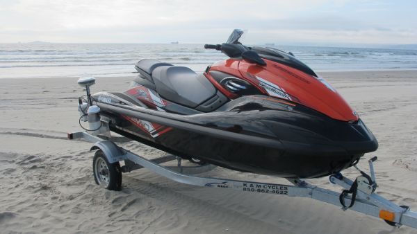
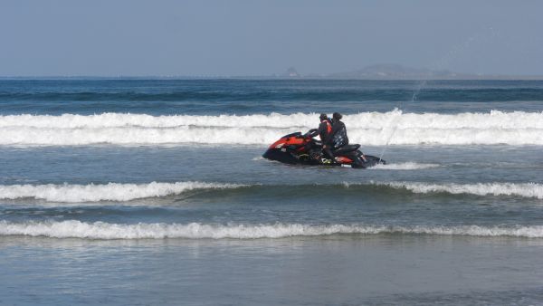
Bathymetry
Beaches: Playa Hermosa (since Ago14); Granada Cove, Stacks y San Miguel (Ago15-Ago16); Ciprés y Barra del Estero (since Ago 15); La Misión (since Ago 15).
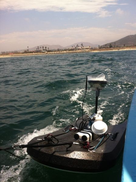
Instrumentation: differential GPS (Leica) synchronized to an echo-sounder (integrated on an ADCP Sontek M9).
Measuring: continuously at 1Hz with small vessel on rocky beaches and jetsky on sandy beaches.
Frecuency: monthly (since Ago14)
Profile spacing: @100m at Playa Hermosa, Granada Cove, San Miguel, Stacks y La Misión; @250 m at Ciprés and Barra de Estero.
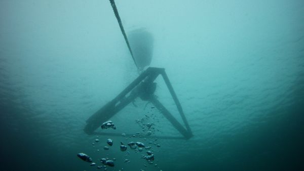
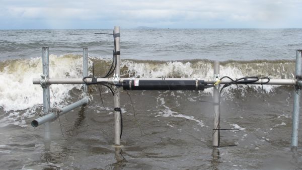
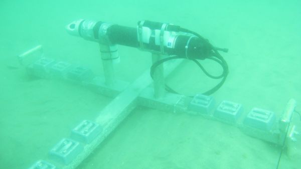
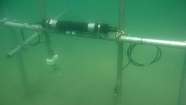
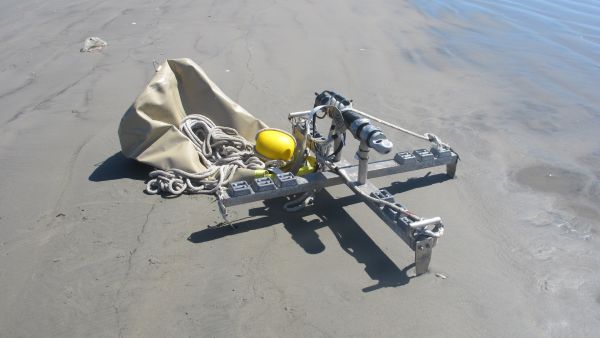
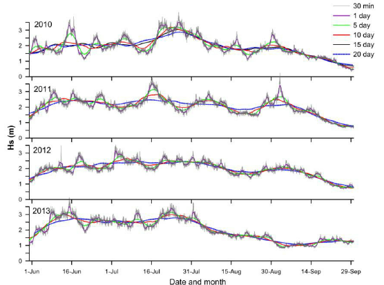
Waves and Currents
Beaches: Playa Hermosa (since Oct 13); Barra del Estero (since Nov 17); La Misión (since May 17).
Instrumentationn: ADCP (AWAC Nortek) of 1MHz and 600 kHz installed at approximately 20 m depth.
Measurements: waves hourly over 17 min at 1Hz and hourly current profiles during 20 min at 1Hz.
Frequency: continuously
Variables: Hs, Tp and wave direction; U, V, W velocity components at 1 m cells; bottom pressure and temperature.
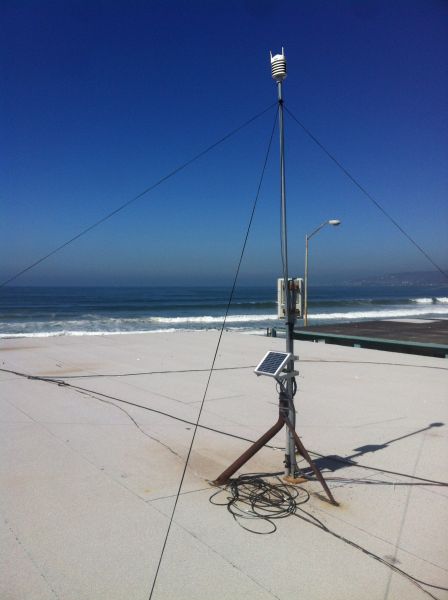
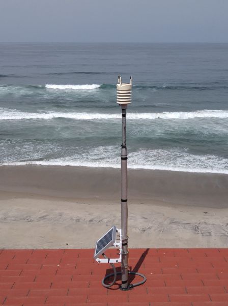
Meteorological stations
Beaches: Playa Hermosa (since Mar 14); La Fonda (since May 17).
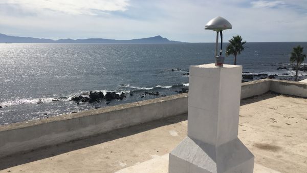
Instrumentation: automatic Vaisala WXT520 station with a solar pannel at approximately 10 m from mean low tide level
Measurements: 10-min averaged
Frequency: continuously
Variables: wind speed and direction, air temperature and relative humidity, barometric pressure and precipitation.
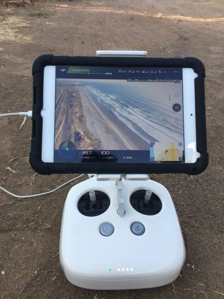
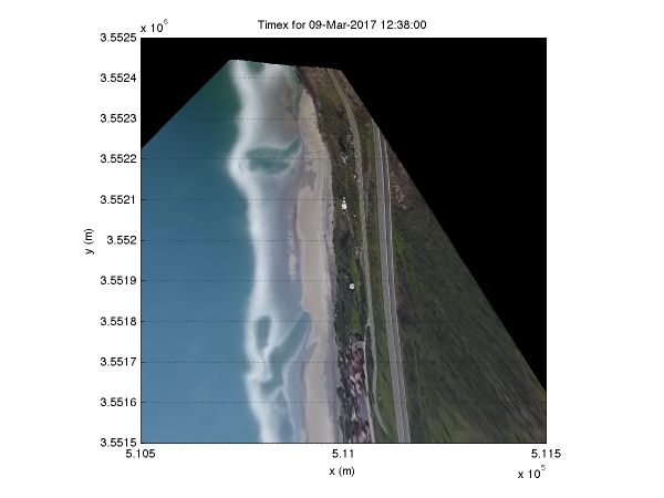
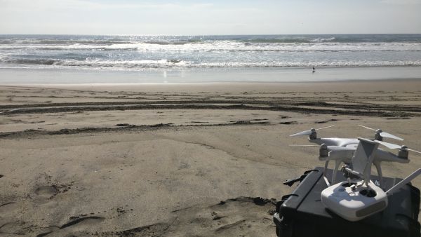
Video-monitoring with Unmaned Aerial Vehicles (UAVs)
Beaches: La Misión (since Oct 16).
Instrumentation: DJI Phantom 4 and Phantom 4 Pro
Measurements: videos at 30fps and 4k with approximate duration of 8 min from a fixed position. Two measuring points (North and South La Misión). Image processing following Holman et al. (2017).
Frequency: weekly/fortnightly
Products after image processing: Oblique images. Orthorectified and georeferenced 8-min averaged images (timex). Time-stack of pixel lines to evaluate runup and longshore/cross-shore currents.
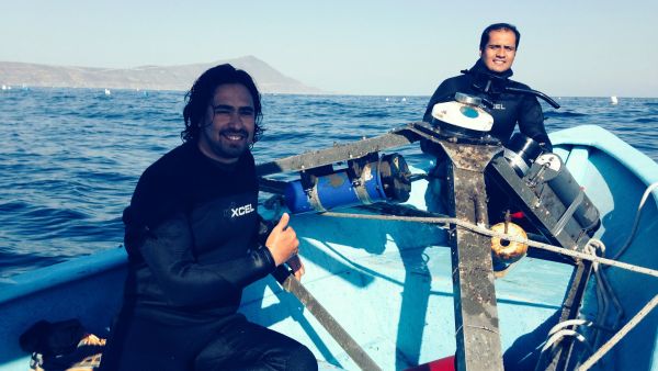
Intensive field campaigns: hydrodynamic and morphological measurements
Beaches: Sisal (Yucatán) Apr 14; Barra Estero (Ensenada, B.C.) Jun 16.
Instrumentation: Accoustic Velocimeters (ADV, Vector de Nortek) with optical backscatter sensors (OBS Campbell); Accoustic Doppler Current Profilers (ADCP, Aquadopps y AWAC de Nortek); Pressure sensors (RBR); differential GPS Leica; Echo-sounders integrated on ADCPs (M9 Sontek);
Measurements: daily topography and bathymetric measurements; continuous current and turbidity measurements at 16Hz; continuous pressure at 4Hz; daily sediment samples at the supratidal, intertidal and subtidal beach;continuous 10-min averaged meteorological measurements.
La Misión Beach
Measurements
- Topography and bathymetry since Nov 2015
- ADCP since May 2017
- Meteorological since May 2017
- Unmanned Aerial Vehicle (UAV) since Mar 2017
San Miguel Beach
Measurements
- Topography and bathymetry: Aug 2015 to Aug 2016
- ADCP since Dec 2016
- Meteorological (IIO) since 2012
Stacks Beach
Measurements
- Topography and bathymetry: Aug 2015 to Aug 2016
- ADCP since Dec 2016
- Meteorological (IIO) since 2012
Granada Cove Beach
Measurements
- Topography and bathymetry: Aug 2015 to Aug 2016
- ADCP since Dec 2016
- Meteorological (IIO) since 2012
Playa Hermosa Beach
Measurements
- Topography since Nov 2012
- Topography and bathymetry since Aug 2014
- ADCP since Oct 2013
- Meteorologial since Mar 2014
Ciprés Beach
Measurements
- Topography and bathymetry since Aug 2015
- ADCP since Nov 2017
Barra Estero Beach
Measurements
- Topography and bathymetry since Aug 2015
- ADCP since Nov 2017